
On October 12, as the most powerful hurricane to hit the U.S in 27 years exited the country and dissipated into the Atlantic ocean, the path of an increasingly-erratic hurricane Leslie was 19 days into a near-month long existence that would culminate in widespread destruction throughout central and northern Portugal unseen for over 170 years.
 The National Hurricane Center (NHC) first initiated advisories on subtropical storm Leslie on 23 September. Initially, the storm’s future evolution was uncertain, due to the possibility of a larger low-pressure system becoming dominant and absorbing it.
Over the next couple of days Leslie drifted eastward without changing in intensity, before weakening into a subtropical depression on 25 September. Six hours later, Leslie became an extratropical cyclone.
Later that same day, Leslie merged with an approaching frontal system and subsequently strengthened.
On 27 September, Leslie acquired hurricane-force winds before becoming full tropical two days later.

For the next day and a half Leslie meandered over the north Atlantic without any change in intensity before becoming a hurricane on 3 October, reaching its initial peak intensity with maximum sustained winds of 80 mph.
Continuing along an increasingly rare, historical trend-defying trajectory, Leslie began to weaken once more, becoming a tropical storm until 10 October when it achieved hurricane status for a second time.
It later reached peak intensity with sustained winds of 90 mph on 12 October before beginning to weaken once more.
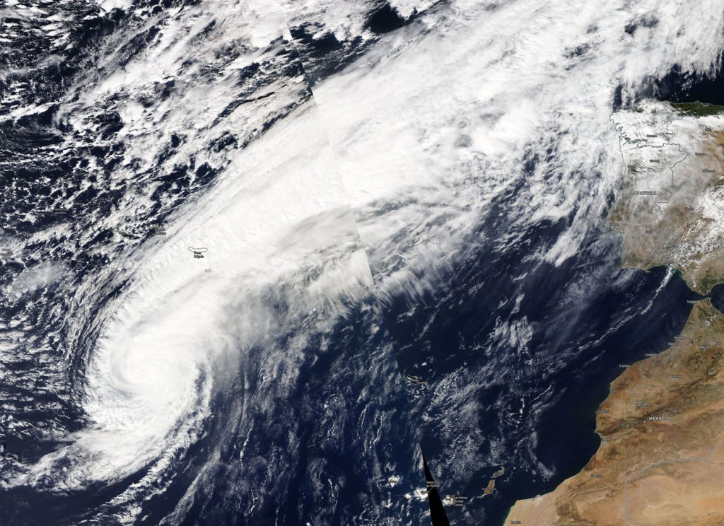
By 13 October, Leslie fell below hurricane strength as it transitioned into an extratropical cyclone while situated about 120 miles west-northwest of Lisbon, Portugal.
Soon after the NHC issued its last advisory on the extratropical storm, Leslie’s made landfall in the coastal city of Figueira da Foz, 20 days after first appearing in the mid-Atlantic.
With wind gusts of up to 109 mph it was the strongest storm to hit Iberian peninsula since 1842 and prompted the issuance of tropical storm watches and warnings for Madeira Island, the first in recorded history.
The storm teared through the peninsula in a northeastern trajectory uprooting over 1,000 trees and leaving 300,000 homes without power.
“I have never seen anything like it, The town seemed to be in a state of war, with cars smashed by fallen trees. People were very worried,” a resident of Figueira da Foz told local reporters.
Heavy rainfall has since triggered deadly flash flooding in the Aude region of southern France, with at least 13 killed in flash floods that were triggered by several months’ of rain falling in just a few hours, according to the Associated Press.
Several victims were reportedly swept away by the torrent of water while sleeping.
Meanwhile, the city of Carcassonne received 141 mm (5.6 inches) of rain during the flood; more than 200% of the normal monthly rainfall for all of October.
The villages of Conques-sur-Orbiel and Villardonnel are reportedly among the hardest-hit areas, where floodwaters reached the first-floor windows of homes; the town of Trebes saw water levels rise eight meters (26 feet) in just five hours.
Accuweather reports that around 1,000 people have been evacuated due to fears of a dam failure near Carcassonne, while residents are being advised to stay home and schools in the area remain closed.
Additional showers are expected across the region early this week; however, no heavy rainfall is forecast in the next 24 hours.
